Shopping Cart

0

Your shopping bag is empty

Go to the shop

Grader Leveling System RTK Agricultural Land Leveling

Rs.0.00

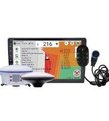
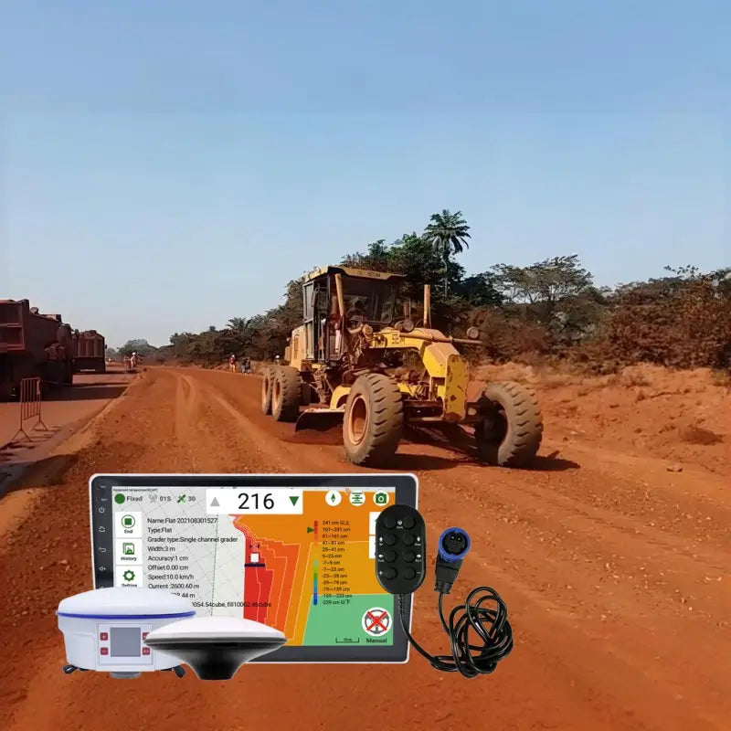
The system facilitates accurate measurement of areas, lengths, maximum and minimum heights, and calculates average heights for earthworks. It automatically determines the plane height based on average measurements, completing land leveling. The inclined plane operation requires only setting the start and end heights, eliminating the need for a base station....

Real time Visitor right now
sold in last Hour

HURRY! ONLY LEFT IN STOCK

Dresses Size Chart

Dress Size Chart (Inch)
DRESSES
SIZE IN INCHES
SIZE US / CAN BUST WAIST HIPS
XS 0 31"-32" 24"-25" 34"-35"
S 2-4 33"-34" 26"-27" 36"-37"
M 6-8 35"-36" 28"-29" 38"-39"
L 10-12 37"-39" 30"-32" 40"-42"
XL 14 40"-42" 33"-35" 43"-45"
Dress Size Chart (cm)
DRESSES
SIZE IN CM
SIZE US / CAN BUST WAIST HIPS
XS 0 78.7-81.2 60.9-63.5 86.3-88.9
S 2-4 83.8-86.3 66-68.5 91.4-93.9
M 6-8 88.9-91.4 71.1-73.6 96.5-99
L 10-12 93.9-99 76.2-81.2 101.6-106.6
XL 14 101.6-106.6 81.2-88.9 109.2-114.3

Swimwear Size Chart

Dress Size Chart (Inch)
SWIMWEAR
SIZE IN INCHES
SIZE US / CAN BUST WAIST HIPS
XS 0 31"-32" 24"-25" 33"-34"
S 2 33"-34" 26"-27" 35"-37"
M 4 35"-36" 28"-29" 37"-38"
L 6 37"-39" 30"-32" 39"-41"
XL 8 40"-42" 33"-35" 42"-44"

Shoes Size Chart

US EURO UK AUS JAPAN CHINA
5 35-36 3 3.5 21.5 35
5.5 36 3.5 4 22 35.5
6 36-37 4 4.5 22.5 36
6.5 37 4.5 5 23 36.5
7 37-38 5 5.5 23.5 37
7.5 38 5.5 6 24 37.5
8 38-39 6 6.5 24.5 38
8.5 39 6.5 7 25 38.5
9 39-40 7 7.5 25.5 39
9.5 40 7.5 8 26 39.5
10 40-41 8 8.5 26.5 40
11 41-42 9 9.5 27.5 41

Delivery

    All orders shipped with UPS Express.

    Always free shipping for orders over US $250.

    All orders are shipped with a UPS tracking number.

Returns

    Items returned within 14 days of their original shipment date in same as new condition will be eligible for a full refund or store credit.

    Refunds will be charged back to the original form of payment used for purchase.

    Customer is responsible for shipping charges when making returns and shipping/handling fees of original purchase is non-refundable.

    All sale items are final purchases.

Help

Give us a shout if you have any other questions and/or concerns.

Email:

Phone: +1 (23) 456 789

Ask a Question

The system facilitates accurate measurement of areas, lengths, maximum and minimum heights, and calculates average heights for earthworks. It automatically determines the plane height based on average measurements, completing land leveling. The inclined plane operation requires only setting the start and end heights, eliminating the need for a base station. Connectivity to various network differential systems and remote monitoring of vehicle position and status are also supported.

Measurement of Pilots 

Measurement of areas, length, maximum heights, calculation of average heights of earth work, preparation of topographic maps

Make the plane

According to the average height obtained from the measurement, the height of the plane is determined automatically, and the land leveling operation is completed. 

Make Incline 

Based on the next results only the start and end heights of the incline need to be set to complete the single incline operation. 

Dual inclined Plane

Based on the measurement results, you only need to set the start and end heights of the inclined plane to complete the dual inclined plane operation differential. 

Network

No need to set up a base station, supports connectivity to Thousand position network differential,  NTRIP Network differential of local mapping systems

Remote Monitoring 

Support remote monitoring of vehicle position and operation status. 

It can be used with various types and sizes of graders.

Specification


Hardware

Appearance Dimension

256*156*42

Protection

IP65

Satellite Antenna

Support 2 way(Main/Sub)

Data Interface

Support(1 way)

Wi Fi

IEEE802.11b/g/n

4G

LTE-FDD:B1/B3/B5/B8

LTE-TDD:B34/B38/B39/B40/B41

Bluetooth

SPP, BLE

Camera

Support (1 way)

Sim Crad

Support dual card dual standby

Speaker

Support

Display

10.1 inch

RAM

2GB+16GB

Technical

System

Android 10.0

Satellite System

Full system & Full frequency point


Frequency Band

DBS :  B1I B2I B3I B1C B2a B2b

GPS : L1C/A L1C L2C L5C

GLONASS : L1 L2 L1C

GALILEO: E1 E2 E5a E5b E6

QZSS: L1 L2 L5 L6

RTK Accuracy

Plane: 1cm+1ppm

High: 1.5cm+1ppm

Time Accuracy

20ns

Targeted Accuracy

0.2 Degrees/1m Baseline

Speed Accuracy

0.03m/s

RTK Initialization Time

<5s

Differential Method

NTRIP, GPS MQTT, Base Station, LoRa 

Work Environment

Working Temperature

-20℃ ~ 70℃

Working Voltage

9~16VDC

Working Current

2.5A Max


Specification


Satellite Antenna

Hardware

Appearance Dimension  

  Φ142*66.5mm

Protection

IP65

Connector specification

TNC female

Centering Rod Thread

5/8" -11

Technical


Frequency Band


BDS:B1I B2I B3I B1C B2a B2b

GPS:L1 L2 L5

GLONASS:L1 L2 L3

GALILEO:E1 E5a E5b E6

QZSS:L1 L2 L5 L6

Working Temperature

-20℃ ~ 70℃

Appearance Dimension

                              Φ171*76mm

Protection   

 IP55

Rated Torque

7N. m

Rated Current

10A

Rated Power

50W

Rated Speed

80 (100) r/min

Peak Torque

16N.m

Work Environment

Working Temperature

-25℃ ~ 55℃

Humidity

5%-90%RH

Angle Sensor

 Hardware

Appearance Dimension  

 Φ114*67.5mm

Protection

IP67

Accuracy

0.01℃

Data Rate 

10Hz

Work Environment

Working Temperature

  -20℃ ~ 70℃

Working Voltage

5v

More Infomation To You

Things you need to know

We use industry standard SSL encryption to protect your details. Potentially sensitive information such as your name, address and card details are encoded so they can only be read on the secure server.

  • Safe Payments
  • Accept Credit Cart
  • Different Payment Method
  • Price Include VAT
  • Easy To Order

Express Delivery

  • Europe & USA within 2-4 days
  • Rest of the world within 3-7 days
  • Selected locations